Wednesday 18 December 2013

The Railway Guide to New South Wales (part one)

The expansion of the New South Wales railway network led to the NSW Government publishing the The Railway Guide of New South Wales: for the use of Tourists, Excursionists, and Others in 1879. Further network expansion led to an updated illustrated edition in 1884. Below we read the first entry on the partially opened section of the Wallerawang to Mudgee branch line. At the time of writing the end of the line was at Capertee.

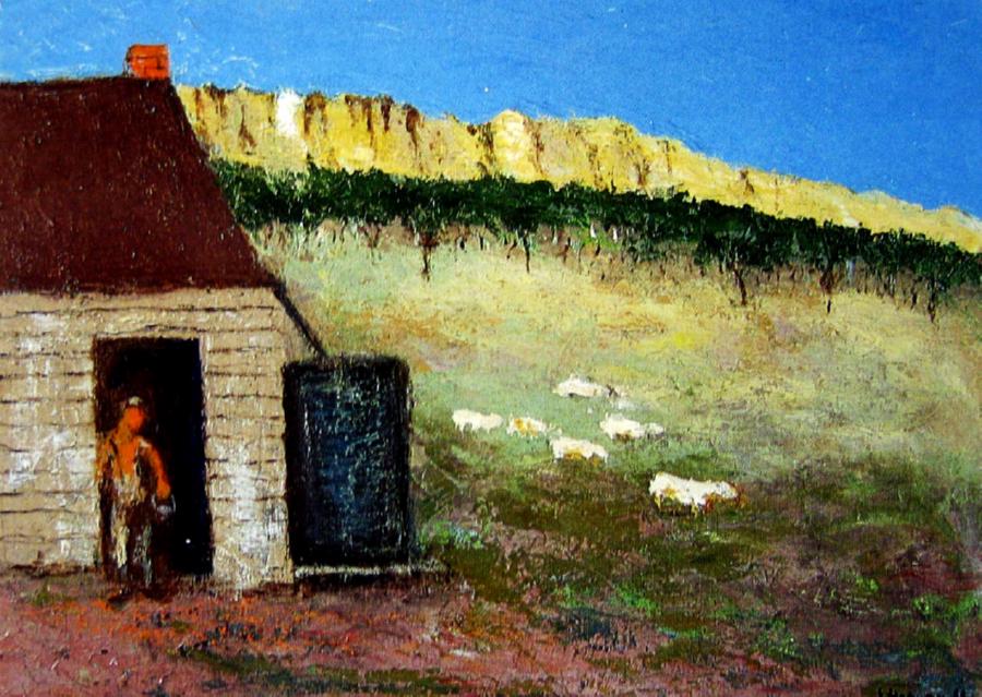
Original kerosene mine, Hartly Vale
from The Railway Guide to NSW (1884)

Extension, Wallerawang to Mudgee

There is now in progress an extension from Wallerawang to Mudgee, a distance of about 85 miles. In May, 1882, a section of this line from Wallerawang to Capertee, a distance of 22 miles, was opened for traffic. The line passes through very rough country, the scenery resembling that passed between Mt. Victoria and Emu Plains, and in the vicinity of Capertee are some views that are unsupassed by the most noted on the Blue Mountains. Of the views near Capertee may be mentioned the Crown Ridge, a lofty and rocky mountain, from which a magnificent view is obtained; the Gorge, the rocks here resembling the rocks at the entrance to Port Jackson; and the Capertee Caves, interesting on account of the many impressions, apparently made by human hands, on the sides and walls. A great deal of traffic now passes through Capertee, making it a busy place. The station lies on the border of the extensive mining area embracing Gulgong, Mudgee, Cudgegong, Windeyer, Hargraves, Sofala, &c., and goods are received for these places. In other parts agriculture is carried on, and there is also forwarded from Capertee a considerable amount of pastoral produce and live stock. The extension to Mudgee is being pushed forward with all speed, and the opening is to take place on the 30th June 1884. With the extension of the line beyond Capertee this station will lose much of its present importance. Between Wallerawang and Capertee are some extensive lime quarries, and in the district splendid seams of coal exist, which however are not at present worked. Capertee contains three hotels.

Sunday 15 December 2013

The Railway Guide of New South Wales (part 2)

The expansion of the New South Wales railway network led to the NSW Government publishing the The Railway Guide of New South Wales: for the use of Tourists, Excursionists, and Others in 1879 and 1884. Further network expansion led to an updated illustrated editions in 1886. Below we read part of the entry on the recently completed Wallerawang to Mudgee branch line transcribed from the 1886 edition. 

Zig-Zag railway, illustration by J C Hoyte
from 1886 Railway Guide of New South Wales 

Extension Wallerawang to Mudgee


The history of the Railway Extension to Mudgee shows a splendid proof of the success of persistency. For many years this extension was fought for determinedly by the Mudgee people; but various Governments, deterred by the heavy estimates given as to the cost of the line, and the dim prospect of a remunerative return, would not for a long time listen to the appeals of those interested, until at last one Ministry, seeing beyond the mountain barrier a wealthy land of promise and the opening up and development of mineral resources and wide areas of land, determined to propose the line, a proposition which met with the approval of the then Parliament. Accordingly the line was proceeded with, and in September, 1884, the Mudgee people heard the whistle of the iron horse as it gaily made its way across the plains bordering the quiet Cudgegong. The line starts from Wallerawang, which long enjoyed a greater share of prosperity by reason of its position as the junction of the Mudgee road with the Western Railway.

Piper’s Flat, 110 miles; 3,187 feet above sea-level. – The line runs north-west from Wallerawang outwards to Piper’s Flat, the first station; the country is uninteresting, the land being poor and timbered with stunted specimens of white gum. The station is kept busy only by the mineral traffic, the Wallerawang Company’s Coal-mine being in the vicinity, which, in 1884, had a contract to supply the Government with some 75,000 tons [of] coal at the remarkably low rate of 5s. per ton. The district is essentially a mining one, near the station coal is in abundance, and spread over the locality are extensive deposits of lime, which is principally shipped from the next platform, Ben Bullen, at 121 miles.

Capertee, 127 miles; 2,739 feet above sea-level. – The line from Ben Bullen to Capertee is uninteresting until within a short distance of Capertee, when, after emerging from the darkness of the Capertee tunnel, the traveller sees spread before him a glorious panoramic view of Capertee Valley. The railway skirts round its edges, and down below him extends the valley, its uneven and thickly timbered surface heaving, it would appear, like mighty waves. Far back stands a frowning battlement of dark bold rocks forming a head and crown to the body of the valley below, these cliffs wonderfully square and regular being aptly termed the Crown Ridge. The train in the fall of the year clears this spot towards sunset, and the long golden sunbeams of the evening as they gleam across the waving tree-tops in the valley, light up this crown with golden refulgence of light smoothing down its forbidding sternness and setting gems over its rocky face. The railway runs round this valley for some distance on its way to Rylstone, and between the steep cuttings a fair vista of this picturesque valley is every now and again seen. The valley contains good timber; but of course the difficulty of transit militates against any use being made of the forests. Good sporting is to be had in among the tall grey-gums, game being plentiful in the valley, and the kangaroos are as thick as sheep on a good run. Capertee cannot be called a thriving place; it boasts of one inn and occasionally sends a little traffic over towards the Turon (14 miles), where some gold seekers are working.

Ilford, 149 miles; 2,450 feet above sea-level. – Between Ilford and Capertee the line runs for some distance as already mentioned along the head of the Capertee valley, the line crawling as it were along the side of the cliffs that drop down into the valley. The cuttings are both numerous and extensive, and at times an uneasy feeling creeps over the traveller, that one of the overhanging rocks above him will fall across the ironway. The nature of the country at this place is that known as “rotten,” and in order to make traffic secure, and to prevent the probability of danger, the trains always run through in the daylight. The scenery is bold and striking, the mountains towering hundreds of feet overhead and the passing views are sufficiently varied to show a long succession of panoramic views as the trains sped onwards.


The original article continues with further descriptions of the trip towards Mudgee. The Railway Guide to New South View can be viewed at Lithgow Library or the State Library of New South Wales in Sydney.

Saturday 19 October 2013

Local Plants: Pin-cushions in the long paddock

Whether we like it or not many exotics have naturalised in our area. One cheerful immigrant is the Pin-cushion flower (Scabiosa atropurpurea), a plant that's become a common site on local road verges during late spring and summer. This annual or short lived perennial has many flowering varieties and in our area is most commonly seen in its lilac-mauve or dark red forms. This plant grows to about 30-40 cm high and is highly attractive to bees, butterfly's and other insects that feed from its daisy-like flowers. The plant reproduces by seed which are easily spread by the strong winds found on road edges.


The lilac-mauve forms of 
this plant seem the most common

Pin-cushion plants originate from south-west Europe and North Africa and seem to have arrived in our area as a garden escape. The plant enjoys the climatic conditions of the central tablelands. Extremely hardy these plants can take temperatures of -20 C as well as scorching summer heat. They prefer a neutral pH soil so enjoy the less acidic conditions found in the villages of our region, especially near the the town of Portland which is famous for its lime deposits.


The dark red form of this plant
is sometimes known as the Egyptian Rose

While the pin-cushion plant has found a place along many local roadsides there is little evidence of the plant encroaching into bushland. The green roadside strip, sometimes known as the long paddock, is a fertile place to grow for some plants as water regularly runs off the gentle camber of the highway while the granite road base below the thin soil provides valuable minerals not usually found elsewhere. The plants toughness may account for the Scabiosa becoming a common weed around the world.

So next time you drive along the highway lookout for these charming exotic world traveller.

Friday 20 September 2013

The tragic death of Clarie Pirie

Almost all visitors to Capertee will notice the large memorial park in the middle of the village close to the Glen Davies turnoff. This recreational area, which includes a car park, childrens' playground and toilets, is officially named after Clarence Pirie a notable policeman who was stationed in the community during the late 1950s and early 60s. While many police have served the Capertee district well over the years Pirie deserves lasting recognition as he gave his life to protecting the community.


SenCon Clarrie Pirie ( 1960 )
Senior Constable Clarence Pirie
image courtesy NSW Police

Senior Constable Clarence (Clarie) Roy Pirie was born in Paddington, Sydney, in 1920. During World War 2 he joined the army and served in New Guinea. After the war, in 1947, he joined the New South Wales Police Force, and from 1959 to 1960 he was the Officer-in-Charge at Capertee Police Station. 

On the 13th October 1960 he was asked to look out for two male offenders who had abandoned a stolen car north of Capertee.While patrolling the area the following day, Pirie found two 14 year-olds with a vehicle at a roadside camping site at Jews Creeks south of Capertee. According to police records, these were not the suspects who had abandoned the vehicle the previous day but two escapees from the Yasmar juvenile detention centre in Haberfield, Sydney. While interviewing the youths one of them suddenly produced a stolen .22 rifle and shot the officer twice. The Senior Constable died of his wounds at the scene a short time after. The two youths were arrested the following day and were later imprisoned. Pirie was survived by his wife Frances and four young children.

The memory of Clarie Pirie as well as the many other police who have been killed in the line of duty is commemorated each year on Police Memorial Day which is held near the end of September.


Sunday 11 August 2013

The view from the train window

While the nearby Blue Mountains attract most of the tourists, the Capertee district has stunning landscapes which are the equal of its better known neighbour. The local tourist office tries its best to promote the district, and recently described the Capertee Valley on its website, as an area of ‘spectacular scenery and timeless beauty’. Surprisingly  talking about the charms of the region is not a recent development. One of the first people to promote the tourist potential of the area was a letter writer to the Sydney Morning Herald in 1888. This anonymous correspondent took exception to an earlier report in the paper that ignored the scenic qualities of the Capertee area in a story about railway tourism within the state. 


Crown Ridge looking East, watercolour by Conrad Martens
Mitchell Library, State Library of NSW


SCENERY ON THE RAILWAY LINES

To a sub-leader of October 29 you make mention of the scenery along different lines of our railways, but I notice with regret that you omit mention altogether of the Mudgee line from Ben Bullen to Ilford, a distance of about 20 miles, the railway skirts the vast depression of the Capertee Valley, and as the train winds around the Crown Ridge, near Capertee Station, and further on by Carlos Gap and Brogan’s Creek, the view is in my opinion unequalled on any line of railway in the colony. The tremendous masses of Hawkesbury sandstone, in many cases showing a perpendicular unbroken face of 300ft., towering higher and yet higher in the distance, until the Bulga Mountains overlooking Singleton can be distinctly seen, and the lofty cone-shaped Tien Peak with its trigonometrical station at its summit, present all weathers one of the finest spectacles of rugged mountain scenery in Australia.

To those tourists who are tired of the beaten track of the Blue Mountains, as represented by Katoomba, Blackheath, and Mount Victoria, I would recommend a visit to the Capertee district. There is a hotel close to the railway station, where good accommodation can be obtained. I am confident that the beauties of this place are but to be seen and explored to be appreciated, and I predict a future before it second only to Katoomba. To the geologist it presents special features of interest. At few places in New South Wales are there so many or such a variety of fossil and petrefactions [sic] obtainable. The late Professor Denton spent some time at the place, and expressed great interest in all he saw. He gave it as his opinion that the vast depression was at one time one of the largest fresh-water lakes in the colony.

Friday 2 August 2013

Ian Brown - nature photographer

A regular visitor to the Capertee district is the Blue Mountains-based photographer Ian Brown. While many photographers are happy to take shots from lookouts and roadsides, Ian is a keen bush walker, rock climber and paddler so is able to take images rarely seen by others. In this post we include several of his photos which were taken in the Capertee area.

Pantoneys Crown, photo by Ian Brown

Pantoneys Crown is one of the most recognisable rock features in the Capertee Valley. Here we see a sunrise shot of the massif from Point Cameron in the Gardens of Stone National Park. On the horizon behind Pantoneys Crown are the peaks of the Mugii Murumban-Ban State Conservation Area. The image was taken by Ian in May 2011.

Capertee Gorge, photo by Ian Brown

This photo of Capertee Gorge was taken near Gospers Creek during a rain shower in June 2013. The location is in the Wollemi National Park and a similar image will be in Ian's limited edition 2014 Wild Blue Mountains Calendar which will be available for sale in September. The Capertee River Gorge and the rocky tops of the Gardens of Stone NP are Ian's favourite walking spots in the area.

Capertee River, photo by Ian Brown
Amateur photographers know so well the difficulty in getting evenly-lit images in locations with both sun and shade, but in this photo Ian nails it. This view of the Capertee River was taken in the morning during November 2012. The location was about 10 km downstream of Coorongooba camp ground in the Wollemi National Park.

Photographer Ian Brown in the Fiordland 
National Park in New Zealand

Growing out of a love of bushwalking Ian has been a serious photographer for about 30 years. Photography was his response to the magnificent landscapes he was seeing and a way of conveying this to others. Later photography became integral to his involvement in nature conservation and a way of arguing for protection of wilderness. Reflecting this, Ian authored a fantastic book in 2003 titled Wild Blue: World Heritage splendour of the Greater Blue Mountains, a well illustrated environmental and natural history of the area. His work has also appeared in numerous calendars, diaries, books and other publications, and has been widely exhibited in the Blue Mountains.

Ian usually takes two cameras on his vigorous bushwalks, a Canon 'full frame' digital and a metal 4x5 inch view camera. Earlier this year Ian was short-listed in the Wilderness category for the prestigious Australian Geographic Wildlife Photographer of the Year award.

We hope you enjoyed seeing a few of Ian's fine images, and we hope to show more of his work in the future. For more information about Ian's images and publications please refer to his website at the following link.
http://ianbrownphotography.com.au/

Thursday 18 July 2013

Turning of the First Sod

Prior to the arrival of the railway in 1882 the village of Capertee was an ‘insignificant place’ on the road between Lithgow and Mudgee. While there were a few houses, farms and inns in the area the arrival of the railway was, arguably, the foundation event in the settlements history. In the Town and Country Journal (25th September 1880) we read of the excitement in the district when construction works began on the first section of the branch railway from Wallerawang to Capertee Camp (as Capertee village was then known).


Capertee Railway Station - the end of the first section of the Wallerawang to Mudgee branch line


Turning of the First Sod of the Mudgee-Wallerawang Railway

The small and quiet town of Wallerawang situated just beyond the Blue Mountains, is to-day the scene of the turning of the first sod of the railway to Mudgee, whose inhabitants are evincing great interest in the ceremony, and for their conveyance Cobb's coaches and almost every other description of vehicle has been brought to use. A good number of people from Mudgee and the surrounding district arrived yesterday and during the night. Two special coaches, heavily laden with passengers from these places reached Wallerawang at 9 o'clock this morning, and other people, many on horseback, are pouring into the hamlet. The few who arrived from Sydney and stations along the line by the mail train at half-past 1 o'clock this morning, found it impossible to secure accommodation, and several who came just before by the Mudgee coach were compelled to go to Lithgow, some 10 miles down the line. The Royal, Commercial, and Railway Hotels, and most of the private residences were crowded to their utmost extent with visitors. The night was frosty, and piercingly cold - so cold that your representative is conscious of the fact that he, thanks to the good nature of one of the station officials, escaped from freezing by being allowed to remain bedless and beddingless in the ladies' waiting-room. He passed a miserable night, and in a half-hour's slumber dreamt that he was undergoing some approved though prolonged process of refrigeration, and contemplates for a reason, afterwards thinking he is in Wallerawang. Daylight broke magnificently fine, and so far the sky has continued cloudless. For the special indulgence of the navvies, the contractors have furnished several large casks of beer; it is somewhat significant that where it is placed there are no holes, but abundance of water; the navvy force has been considerably augmented from the surrounding neighbourhood.

This section of the line to Mudgee is 22 miles 54 chains in extent, branching off the Great Western line at a point some quarter of a mile distant from the Wallerawang railway station, thence proceeding in a north-west direction, and ending at an insignificant place named Capertee Camp. The contractors are Messrs. Monie and Mathieson, who constructed the Dunolly and St. Arnaud line, and other large public works in Victoria. The amount of their tender for this section of the Mudgee railway was £180,600, and the time allowed for the completion of the contract is 19 months from the time of commencing. Operations were started on the 3rd of the present month. The work done up to the present consists principally of clearing the timber from the junction onwards. Already the timber has been cleared for some 11 miles, and cuttings scattered over the first eight miles are in progress. the timber for bridge piles has been hewn, and large quantities of bricks, stone, and earthenware pipes, for culverts and drains, are in readiness for use. Over 300 men are now employed, and in the course of a few months the contractors expect to have fully 1000 on the works, the number employed being increased every day. They have had no difficulty in procuring men, and none is anticipated, although good navvies are rather scarce so far. Bricks are brought from Lithgow, but the contractors propose to erect kilns and make their own bricks. The timber for piles can be obtained in abundance along the route, any kind, provided it is round, being used - except white gum, which is disallowed - and pile driving will commence next week. It is probable that, after the construction of the first few miles of railway from Wallerawang, various sub-contracts will be let by the contractor-in-chief. As is evident from the cost of this section, there are many cuttings to be made, more particularly towards the end of the section, in some places the ground being extremely hard and the cuttings deep. The deepest will be over 50ft, and the largest nearly 100,000 yards, including the only tunnel, which will be 187 yards in length. This cutting and tunnel will be made towards the end of the section, and others at different parts of the route. the line, in consequence of the roughness of the country over which it must pass, will be rather circuitous, and the curves almost continuous, though not near so great as those on the mountains. The deepest gradient will be one in 48, others varying from that downwards. The carrying out of this section will include the erection of seven timber bridges, all of one size, namely, 86 yards , crossing small creeks. No station will be required at any part, except at the end of the first section, for some time after the opening of the line, unless during its construction an impetus to settlement on some of the intermediate parts is given. The length of the line, when finished right through to Mudgee, will be 86 miles, to be made up of three sections. Whether or not the Government will await the completion of the first section before they invite tenders for the second or third is not known, and on this point the people of Mudgee, whom the railway will mostly benefit, evince some anxiety. Perhaps the want of railway communication with the town and district of Mudgee, and the inconvenience or rather distastefulness of travelling long distances by coach, as compared with travelling by rail, were never more demonstrated than at Wallerawang last evening when two Darlinghurst prisoners heavily ironed were brought from Sydney bound for Mudgee. They could not be seated on the box with their keeper, consequently two well-known and highly respected ladies, the only other passengers, had preference to sit nearly 12 hours in a small coach - with these gaol birds, who were attired in prison habiliments, and could not move withought the clanking of their irons being heard.

Saturday 15 June 2013

What were our early gardens like?

In a recent post we highlighted an exhibition of photos taken of several Central Tablelands towns by Merlin Beaufoy and Charles Bayliss of the American & Australasian Photographic Company in the early 1870s. Many of the the 3,500 surviving images - known as the Holtermann collection - show views of gardens, and while many of these domestic landscapes are underwhelming, several photos show residents with a deep love of horticulture and gardening. While none of the Holtermann collection images are of early Capertee district gardens, these photographs offer us valuable clues to the look of late Victorian and early 20th century gardens within our own area.

Despite the humble construction of this Hill End home, this
family are clearly proud of their formally laid of garden

The more notable garden images in the Holtermann collection show a preference for formal designed gardens. By this we mean a preference for symmetrical layouts, a style popular since first settlement times.The Hill End photo (seen above) shows a garden with a mix of ornamental and productive plants. The central gravel path is bordered with cottage pinks (Dianthus), while the surrounding beds are filled with roses and other ornamental shrubs. Behind the house is an orchard planted with productive fruit trees. By the size of the trees the garden is only a few years old.

Most plants from that time have not survived due to changing plant fashions, grazing, neglect and bush fires. Despite this, evidence of original plantings can still be seen near many early homes, even when the original building has been lost. Most flowering roses are grafted on tough species rootstocks such as Sweet Briar. While the original bush may have died the understock has survived. Many of the pink flowering single roses we see in spring are often the progeny of original early plantings.

Another formally laid out Hill End garden 

Another 19th century plant to survive is the grey Agave. This plant has survived and prospered near many local mining-era dwellings such as at Airley and Blackman's Crown. Architectural style succulents such as Agave were popular plants in late Victorian and early 20 th century gardens thanks to their ease of culture. These plants reproduce mostly by vegetative growth or by seed.


Despite bush fires, grazing, and neglect, two large circular patches of
19 th century blue-flowered varieties of Iris continue to grow close to 
the front door of a, now lost, miner's cottage near Cherry Tree Hill
One of the toughest and most reliable garden plants from the 19 th century is the Bearded Iris. The only reason the Irises shown above has survived over one hundred years is due to the hardiness of the plant. Iris's have been grown in Australian gardens since colonial era times. They were popular then because they were easy to transport when lifted and reproduced well from annual division.  While many other plants were grown in this garden only the hardy Iris has survived.

One organisation interested in the look of 19 th century gardens is the Australian Garden History Society.This 2,000 strong organisation - formed in 1980 - publishes a fascinating quarterly magazine titled Australian Garden Historyhttp://www.gardenhistorysociety.org.au/

Friday 14 June 2013

Local Parks: Mugii Murrum-ban State Conservation Area

The Capertee district is rich in natural wonders and this has been recognised with the establishment of several local reserves, most notably the Capertee and Gardens of Stone National Parks. The most recent addition to the protected Crown Lands portfolio in the area is the Mugii Murrum-ban State Conservation Area which was established by the former Labor State Government in March 2011.

Apart from some perimeter signs there is little
evidence of any changes in this Conservation Area
 since it was established in 2011

This new Conservation Area consists of 3,650 hectares of land which roughly intersects the Capertee NP (to the north) and the Gardens of Stone NP (to the south). Much of the area of the new Mugii Murrum-ban State Conservation Area includes the picturesque peaks of Mount Genowlan and Mount Airly. While not having the full legal protection of a National Park or World Heritage Area this new reserve is an extension of the Gardens of Stone National Park which was originally established in 1994. The Conservation Area is named after the Wiradjuri Elder, Charley Riley. Mugii is Riley's Wiradjuri name and means a Mopoke Owl, while Murum-ban means eldest son in the Wiradjuri language.

According to the New South Wales National Parks and Wildlife Service the new reserve includes more than 340 different plant species as well as distinctive sandstone and shale rock formations. Native vegetation includes several rare and endangered communities including plants associated with dwarf she-oak heathland, as well as 20 metre high Brown Barrel eucalyptus downstream of the "Grotto". Hopefully future National Parks and Wildlife funding will lead to more knowledge of the Conservation Area being known to the public.

Tangible evidence of the former mining village of Airly
 still survives in the newly established Conservation Area

Much of the drive to establish the reserve was the threat from coal mining in the area. Prior to the establishment of the Conservation Area proposed coal mining would have led to major subsidence as well as possible changes to the water table. After the Conservation Area was announced local miner Centennial Coal publicly welcomed the establishment of this State Conservation Area, but in late 2012 their Airly mine was scaled down due to financial reasons.

As well as the notable local geology and the diverse natural vegetation growing in the reserve, the Mugii Murrum-ban Conservation Area also includes archaeological remains of the former shale mining community of Airly, which was active from 1883-1913.While the nearby mining community of Glen Davis is relatively well documented the century old former shale mining community at Airly clearly shows the speed that human habitation turns to dust. Visible traces of this community includes mining ventilation shafts and the remains of several brick and stone dwellings.


Link to National Parks & Wildlife website: http://www.nationalparks.nsw.gov.au/


Friday 24 May 2013

Artist Profile: Warwick Fuller

One of the best known contemporary landscape painters of the Capertee Valley is the Little Hartley-based artist Warwick Fuller. Warwick has been painting for over 35 years and has had over 60 solo exhibitions. Like the pioneer Capertee Valley painter Robert Johnson (1890-1964) before him, Warwick is a Fellow of the Royal Art Society of New South Wales (FRAS). Below, Warwick writes of his long standing affinity with the landscape of the area and touches on the technical difficulties of being a plein air painter.


Warwick Fuller in his studio with Afternoon sun, Glen Davies

The Capertee Valley was one of the first truly awe inspiring locations in which I painted. That was back in 1976, two years before I started painting full time. I was vaguely mindful of the history of great artists who had made their way into the ramparted protection of this magnificent triassic basin. Robert Johnson, Reg Campbell, Doug Sealy to name a few.


Though I try to not wear out my enthusiasm for this iconic geological marvel, I am drawn back at least once most years. Early on Allan Fizzell and I would camp on the Dunville loop or down near Glen Davis, painting for three or four days at a time. On one trip, when it was raining, I went to Mr Wilson's property 'Tambo' to introduce myself and ask if I may see his Robert Johnson painting. As I pulled up at his gate a flash of late afternoon sunlight broke through. I was out of the van and painting in a flash. A day or two after, I did get to meet Mr Wilson and see that 'Johnson'.

Another early highlight for me was when painting with Robert Simpson in the Valley. Bob painted a little study of morning light that absolutely knocked me out. Along with other early influences, I think that painting unconsciously started my career long struggle to capture the light. I've painted standing in the river during heat waves, I've perched precariously on sandstone cliffs and on car roofs, on steep slopes, in front of mobs of herded cows. I've painted in frosts where the brushes fell out of my hands because of frozen fingers. Rocks have been required to hold my easel down in wind. Flies have tried to carry me away or rearrange my paintings. But it is the enduring joy of being witness to the marvellous light it the valley. The blazing direct summer light on the bluffs, the gentle filtered winter light on pastures and cattle, the long strafing shadows across the valley floor, the reflected glow as the sun dips below the rim.


Change in the Valley (2010), oil by Warwick Fuller

Many artists travel to 'Capertee' these days and their efforts and interpretations are introducing the wider public to this amazing jewel of the Australian landscape. I've seen many changes over the last thirty seven years but the grand valley remains largely unchanged and undiminished. If nurtured by those who care, and we all remain vigilant, our grandchildren will enjoy its beauty as did our grandparents. Other as yet unborn great artists will surely find inspiration here and masterpieces will be created.


For more information about the artist please refer to Warwick Fuller's website: http://www.warwickfuller.com/


Wednesday 8 May 2013

Jack Dawes's cat


The Capertee district has attracted some eccentric types over the years. One such individual was Jack Dawes who lived in the area during the 1930s, 40s and 50s. Jack was a man of very humble means who lived in a water tank in Capertee. His impecunious lifestyle soon attracted the attention of the local police who charged him under the (now repealed) NSW Vagrancy Act. We will leave a newspaper report in the Goulburn Evening Post, of Monday 11th June 1951, to explain the odd details of the case.

The Hermit, Capertee Valley (1988), oil by Sali Herman
image courtasy AASD website
Vagrant Wore Live "Fur" To Keep Warm

A 58-year-old man charged with vagrancy had to be stripped of a large black tom-cat which he claimed he wore to keep him warm when he appeared in Capertee Court of Petty Sessions. The man, Jack Dawes, of Capertee (near Lithgow) was sentenced to three months hard labour.

When Dawes was taken into court, police noticed a large bulge inside his old shirt. Asked what it was, Dawes put his hand into his shirt and pulled out the head of a large tom-cat. He objected when police ordered him to remove the cat in court. He stated that he wore the cat there to keep him warm. He had had the animal for 15 years. The cat was taken from him. After Dawes had been sentenced, Mr. K. Dash, S.M., commented: "I think we'll send the cat with him too. I'm sure we can find a warrant card for it somewhere."

Dawes pleaded not guilty to a charge of having insufficient support. When asked in court how he lived, he commented: "Ben Chifley keeps me!" Apparently Mr. Chifley's patronage was not enough to convince Mr. Dash. He convicted Dawes who was later taken to Lithgow police station. He was then transferred to Bathurst.

Police stated that he lived in a tank in the Capertee district. He had the tank sealed and had to crawl into it through a small hole. Only food stuff which he had with him was cat's meat. He was anxious to take the cat with him.

Some months ago, Det. W. J. Heron, of the Lithgow Police visited the "home" of the accused. He was surprised when Dawes ran-out and sprayed him with eau-de-cologne, explaining that he always kept the perfume on hand for friends.


A big thank you to J. O'Shea, a distant relative of Jack Dawes, for sharing this quirky tale. She believes that her relative died in 1960. In the absence of a photo of Mr Dawes we have reproduced a work by the famous Swiss-born Australian artist Sali Herman (1898-1993), titled 'The Hermit, Capertee Valley'.

Wednesday 1 May 2013

An aerial mystery

In Bruce Jefferys' local history, The Story of Capertee,  a shot of an early aeroplane flying over a hilly bush landscape was reproduced. The image was titled 'Wolgan Valley' and Jeffreys' credits the photo to local photographer Henry (Harry) Mow who was active in the Capertee area during the early years of the last century. On first inspection Mow's photo looks like a tricked-up image, and this was certainly the view of Jefferys. Fake montages of more than one image to create a new composite picture is a common trick used throughout the history of photography. While this undated image is most likely a montage the photo, possibly, refers to early local contact with aeroplanes in the area.


Henry Mow photo of an aeroplane over the Wolgan Valley

In early March 1926, the Windsor and Richmond Gazette reported on a aerial survey of the Capertee district by the Richmond-based aviator Captain Percival that had taken place a week earlier in late February.  According to the report Percival, along with a surveyor and a photographer, left Mascot at 9.30 am in an Avro aeroplane to undertake a preliminary photographic survey of about 50 square miles of 'very rough country several miles beyond Capertee'. According to the report, the survey would reveal the contours of the area to help guide 'the men who, later on, will go over the ground with axe and "jigger" '.

Captain Percival's flight across the mountains, against a stiff westerly wind, took two and a half hours while the return journey took less than an hour. The party returned to Mascot aerodrome at 5pm. There is a suggestion in the newspaper report that the plane may have landed near Capertee during its mission.


A 1935 photo of Edgar Percival
courtesy Wikipedia

The pilot mentioned in the report was the Australian air pioneer Edgar Wikner Percival (1898-1984). Percival first took up flying during the Great War when he joined the British Royal Flying Corp. After the war he returned to Australia with three surplus aircraft, two Avro 504's and a de Havilland DH 6  to do stunt flying, film work and charter flying. During the 1920s he was known to be doing survey work in Australia, and it was during this part of his career that he surveyed the Capertee district.

While the planes being used by Edgar Percival in the early 1920s were bi-planes they were far more modern in design than the aircraft pictured in Mow's Wolgan Valley photo. The aeroplane pictured in his image seems to be an early aeroplane, most likely designed before the Great War. An Internet search soon discovered an image of a biplane flown by Orville and Wilbur Wright which seems very similar to the aircraft shown in Mow's photo. Being such a famous aircraft it is most likely the source of the tricked up image by Mow.

A biplane flown by Orville & Wilbur Wright

By coincidence Captain Percival's aerial survey of the Capertee district in late February took place just a week after Mow died. Because of this, Mow's image cannot have depicted Percival's survey plane of 1924. So either the image commemorates an earlier flight in the area,  or may simply be an experiment in trick photography.

Please let us know if you can identify the aeroplane seen flying in Henry Mow's photograph or can suggest where Percival may have landed in the Capertee area during his 1924 mission.

Link to Wikipedia entry on Edgar W Percival http://en.wikipedia.org/wiki/Edgar_Percival

In later posts we will look at Harry Mow's career and also highlight the work of other photographers of the district.

Friday 19 April 2013

Ritchey Sealy: landscape painter

One contemporary painter inspired by the Capertee district is Ritchey Sealy. Ritchey has been painting for thirty years and learnt his craft from his father, uncle and older brother. While mostly known for his images of the far South Coast of New South Wales he has also painted around other parts of the state including the Central Tablelands.

Stacks at Glen Alice, oil by Ritchey Sealy
image courtesy of the artist

Ritchey was born in Forbes, NSW, in the early 1960s but has lived on the South Coast for many years, residing in the small town of Bodalla close to picturesque hills, beaches and lakes. His studio at Bodalla also acts as a gallery where he sells his work. Ritchie paints mainly outdoors in the French landscape tradition known as en plein air (which translates as 'in the open air').


Artist Ritchey Sealey in his Bodalla studio

He is a fast painter and does not rely on photographs as many other landscape artists increasingly do. Generally, most works take about 3 hours to paint on site with only minor finishing taking place in his studio. Ritchey was 'awe struck' by the Capertee Valley when he first visited and has since painted about 30 works inspired by the Glen Davis and Glen Alice sections of the valley.


Road to Dunville Loop, oil by Richey Sealey
image courtesy of the artist

Ritchey Sealy has won several regional art prizes and his work is included in the Queensland Gallery of Modern Art collection. One of his works was presented to the Duchess of York.

For more information about Ritchey Sealy's work please refer to his website.
http://www.ritcheysealy.com.au/

In future posts we will highlight the work of other contemporary artists inspired by the Capertee district.

Sunday 14 April 2013

Local Plants: Mistletoe - friend or foe?

One of the most fascinating group of plants growing in the Australian bush is mistletoe, and they are often found growing on native trees throughout the district. These plants are sometimes perceived as worthless parasites that weaken trees prior to their death. While this is partially true their value to our environment has been underestimated. Recent research on these highly evolved native plants has led to a reappraisal of their importance to the ecosystem.

The nectar from this local mistletoe flower
 attracts a diverse range of birds, bees and butterfly's

Mistletoe's are a world-wide group of plants which are found in many different habitats. Most early settlers would have known the European Mistletoe (Viscum album), a commonly seen plant culturally associated with pagan fertility rights.

Australia has 85 species of mistletoe, mostly from the Loranthaceae plant family. There are many different species of mistletoe growing in the Capertee district. Most local mistletoes are found growing on open forest and woodland trees such as Eucalyptus, wattles and She-oaks. While most mistletoes photosynthesise from their own leaves they are usually dependent on the hosts sap for water and nutrients.

Mistletoes are often seen growing on trees near the edge of woodland along roads or near cleared land. A 2004 study by ecologist David M Watson near Albury found that 80% of trees growing along habitat edges carried mistletoe compared with fewer than 5% in the interior.The reason for their preference for habitat edges was, according to Watson, related to increased light, decreased fire frequency, increased run off from roads and decreasing numbers of mistletoe eating animals such as possums and gliders at habitat edges. These environment factors have subsequently led to these plants being abundant on the edges of woodland.

While the presence of mistletoe can have a negative affect on the health of the host tree these plants certainly attract a wide range of animals. Associate Professor Watson found that the presence of mistletoe increased the abundance of bird species by 20% or more when compared to similar bush where the mistletoe had been removed. Watson is of the view that the presence of these well adapted plants is 'one of the key factors allowing our woodland-based animals to survive in what's left of their habitat.'


A drooping mistletoe growing on the left
side branch of a local roadside eucalypt
Many birds, animals and insects feed on the flowers, fruit and leaves of mistletoe. Our best known local bird the Regent Honeyeater likes to feed on the nectar and is also known to use the plant as a nesting site. Other birds found feeding on mistletoe include parrots, Eastern-Spinebills and of course the tiny Mistletoebird which feeds on the sticky fruit of the plant. The spreading of the sticky seed by the Mistletoebird is the principal way that new mistletoe plants grow on other host trees. These plants are also important food plants for bees, butterflies and Christmas beetles.


References and further reading

Misunderstood Mistletoe by David M Watson, published in the March 2004 issue of Wingspan magazine


Mistletoes of Southern Australia by David M Watson, CSIRO publishing 2001 (recommended by us)

The Australian National Botanic Garden in Canberra has a fascinating mistletoe web site which will be of interest. http://www.anbg.gov.au/mistletoe/


Related Posts Plugin for WordPress, Blogger...